
Products are selected by our editors, we may earn commission from links on this page.

Strong winds sweeping across parts of the United States have triggered an unusual warning from federal weather officials. Authorities advised millions of residents to stay away from their windows as powerful gusts moved through several states. However, the alert stands out because some warnings remain active for as long as 15 hours.
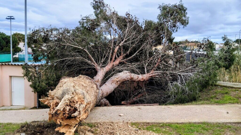
Meteorologists say wind gusts could reach 85 mph in certain areas. Winds at that level can lift loose objects and send debris toward homes and buildings. Yet windows often become the most exposed point when debris travels at high speed.
High wind warnings now cover states across the Midwest and parts of the eastern United States. However, weather offices in those areas have also warned about possible power outages and dangerous travel conditions. Forecasters continue monitoring the storm system as stronger gusts move across the region.
High Wind Warnings Spread Across Multiple States

High wind warnings spread across a large portion of the United States as powerful gusts moved through several regions. National Weather Service offices issued alerts in Michigan, Ohio, Pennsylvania, Indiana, Illinois, Wisconsin, Iowa, Virginia, and West Virginia, and the warnings placed millions of residents under weather alerts through Friday.
Forecasts in those areas pointed to damaging winds capable of knocking down trees and power lines. The National Weather Service office in Grand Rapids warned that travel could become difficult, especially for high-profile vehicles, and the alert also raised concern about widespread power outages.
Local weather offices continued issuing guidance as the storm moved across the region. The National Weather Service office in Baltimore advised residents to remain in the lower levels of their homes during the windstorm and to stay away from windows while gusts intensified.
Difference Between High Wind Warning and Wind Advisory
Weather alerts tied to strong winds often fall into two different categories, and forecasters use each one to signal how severe conditions may become. A high wind warning marks the stronger alert, and it appears when sustained winds or powerful gusts threaten damage across large areas.
Wind advisories describe a lower tier of wind conditions, and the alerts still warn about hazards that can disrupt travel and daily activity. Drivers may struggle to control vehicles as gusts build strength, and unsecured objects outside can begin moving once winds reach those advisory levels.
Forecasters usually reserve high wind warnings for gusts near or above 58 mph, and that threshold signals a greater risk to structures and infrastructure. Power lines may fall, trees may come down, and debris can travel at high speed as gusts intensify across affected regions.
Wind Advisories Expand Across Additional Regions

Wind advisories spread across a broader area as the storm system continued moving across the country. Forecasters issued those advisories from Kentucky north through Wisconsin and east toward New York, and the alerts signaled strong gusts that could still disrupt travel and outdoor activity.
Those advisories followed the same storm system that produced the high wind warnings, so conditions continued developing across multiple regions at the same time. Drivers across advisory zones faced gusty crosswinds on open roads, and unsecured outdoor items could begin moving once wind speeds increased through the day.
Similar advisories also appeared across parts of the Intermountain West as the weather pattern extended beyond the central states. Meteorologists continued monitoring wind conditions across those areas, and additional local alerts began appearing as gusts strengthened and the system moved further across the country.