
Products are selected by our editors, we may earn commission from links on this page.
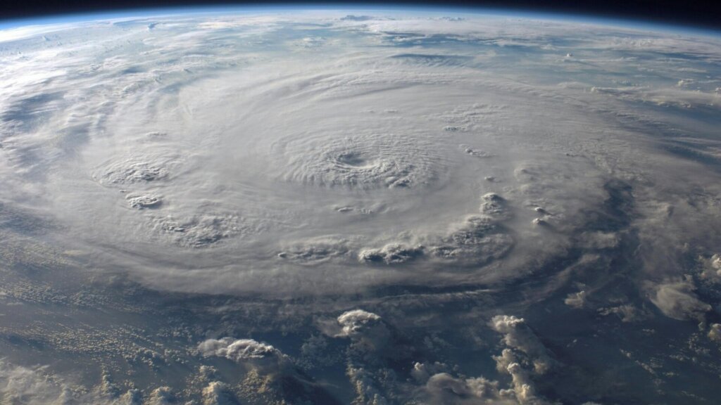
Super Typhoon Sinlaku has emerged as the most powerful storm of 2026 so far, drawing attention from meteorologists and emergency officials across the Pacific. The storm rapidly intensified over warm ocean waters, reaching strength levels that place it among the most significant weather events of the year.
Forecasters tracking Sinlaku say its development reflects a broader pattern of increasingly intense tropical systems. Warm sea surface temperatures and favorable atmospheric conditions have allowed the storm to strengthen quickly, a trend that has become more common in recent years.
As the system moves across the western Pacific, its size and intensity have made it a major concern not only for directly affected areas but also for neighboring regions monitoring its path.
Path Toward U.S. Territory Raises Concerns

Current projections indicate that Sinlaku is moving toward U.S. territory, including Guam and the Northern Mariana Islands. Authorities in these areas have been preparing for potential impacts ranging from strong winds to heavy rainfall and dangerous surf.
Weather alerts issued for Guam highlight the seriousness of the situation, with warnings for flooding, high surf and damaging winds. Even as the storm begins to shift away, lingering effects such as large waves and residual rainfall continue to pose risks.
Officials have urged residents to remain indoors during the most intense periods and to follow emergency guidance. The slow movement of the storm has added to concerns, as prolonged exposure can increase the risk of flooding and infrastructure damage.
Heavy Rain, Wind and Coastal Threats

Sinlaku’s impacts extend beyond wind speed alone. The storm has already brought heavy rainbands capable of triggering flash flooding, particularly in low-lying and coastal areas. In some places, significant rainfall has accumulated in a short period, saturating the ground and increasing runoff risk.
Coastal regions face additional risk from storm surge and powerful waves. Forecasts have warned of hazardous surf conditions, with waves large enough to threaten shorelines, infrastructure and anyone venturing near the water.
Strong winds, meanwhile, can damage buildings, uproot trees and disrupt power systems. Even after the storm weakens, these secondary impacts often linger, complicating recovery efforts for affected communities.
A Season Shaped by Intensifying Storms

Meteorologists note that Sinlaku may be an early indicator of what the 2026 storm season could bring. While each storm is influenced by specific conditions, the broader pattern points to more intense systems fueled by warmer oceans.
Emergency agencies are using the storm as a reminder of the importance of preparedness. From reinforcing structures to maintaining emergency supplies, officials stress that early action can significantly reduce risks.
As Sinlaku continues along its path, attention remains focused on both immediate impacts and longer-term implications. The storm serves as a powerful example of how quickly conditions can escalate and how critical timely information and preparedness are in the face of extreme weather.